PLATINUM 2008
Papers
Technical Programme
Technical Visits
Social Programme
Organisers
Delegate List
Submit Abstract
Deadlines
Venue
Map
Tourist Attractions
Tourist Information
First Announcement (PDF)
Second Announcement (PDF)
Registration Form (PDF)
Hotel Reservation Form (PDF)
Other Conferences
Contact Details
Third International Platinum Conference
'Platinum in Transformation'
Sun City, South Africa, 5-9 October 2008
|

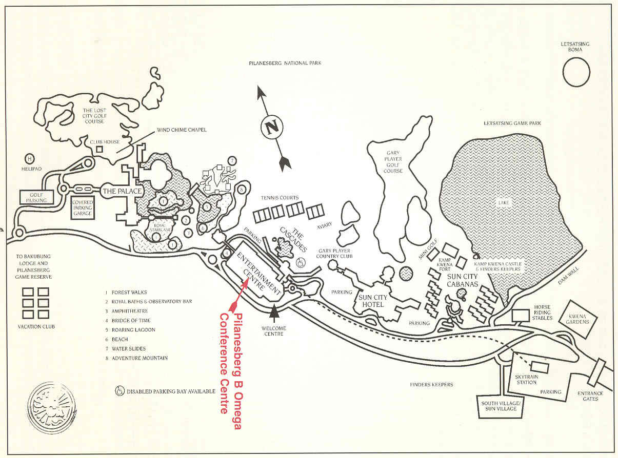
Click on image above to see the enlarged version

|
Outward Bound:
Travel north along William Nicol Drive to Fourways intersection at Witkoppen
Road. Turn left into Witkoppen Road, passing Fourways Mall on your right.
At the first set of traffic lights, turn right into Cedar Avenue. Proceed
for 8.5 km to the T-junction. Lion Bridge Supermarket is on the right.
Turn left and take the first right-hand turn. Proceed 2 km to a
T-junction, passing over the N14 (was R28) freeway. A chicken farm is on
your left. Turn right at the T-junction into the R512. Carry on until the
next T-junction (R27) passing Lanseria Airport turnoff. Turn left on the R512
to Magaliesburg. 9.4 km further on, turn right (R512) towards Brits.
Cross the railway line, and proceed onto the bridge over Hartebeespoort Dam.
At the T-junction, turn right (R512) towards Brits. Travel to a major 4-way
stop (where there are two garages and an open-air craft market). Turn left
towards Brits and Rustenburg. Pass the first turnoff to Brits. Travel
straight on, passing Tropical Gardens on the right. Pass the R27 road on the
right, and the signboard saying 'Sun City 89km'. Travel straight on for
approximately 10 km until you reach the signboard 'Sun City 79km'.
Turn right and cross over the highway, and you are on the direct road to Sun
City.
Homeward Bound:
Leaving the Sun City complex, turn left and travel the direct route for
79 km. At the T-junction, turn left and travel towards the Hartebeespoort
Dam for approximately 15 km to the major 4-way stop. Turn right.
Travel 5 km and turn left on the R512 to Randburg crossing the bridge
over the Hartebeespoort Dam. At the T-junction, turn left (R27) to Pretoria,
(R512) to Randburg. 9.6 km further, turn right on the R512 to
Lanseria Airport. Pass the Lanseria Airport turnoff and travel 3 km.
At that junction, turn left. Proceed past the chicken farm on your right.
Cross over the N14 (was R28) freeway to the T-junction. Turn left and then
first right, and proceed to the Fourways Mall.
Directions from Pretoria:
Select N4, R27, R514, or R513 to the 4-way stop intersection just beyond
the tunnel at Hartebeespoort Dam. Follow directions from this intersection
as detailed on this route map.